Urban Futures: Co-Creating Climate Resilience in NYC Hackathon
Cracked scientists and engineers, policy nerds, frontline community organizers -- this one's for you!

A personal update: I am now moving to full-time status at the Center for New York City Affairs, and will assume the role of Fiscal Policy Analyst. There could not have been a better time for me to return to policymaking with the profound paradigm shifts in New York State politics we have experienced this year. Expect to see much more of my thinking on matters as varied as the New York City Emergency Management Department, the Transitional Finance Authority Act of 1997, and our state’s ninth governor, Martin van Buren. I will still be doing physical oceanography research at Columbia University alongside all of this!
My modus operandi is to bring scientists and policymakers in the same room, because technical people need to be working on big problems. I’m extremely elated to have had the opportunity to help out some brilliant colleagues at Columbia University’s Learning the Earth with Artificial Intelligence and Physics (LEAP), Nvidia, Starr Whitehouse Architects and Planners, and the American Museum of Natural History on this front.
For the last half year, we have been planning a hackathon around using data tools to assist New Yorkers in building a city resilient to extreme weather catastrophes. One component of this is climate model downscaling, and assembling policymakers, scientists, builders, and community organizers at the frontier of urban solutions to extreme weather. Time for an aside.
What is climate model downscaling?
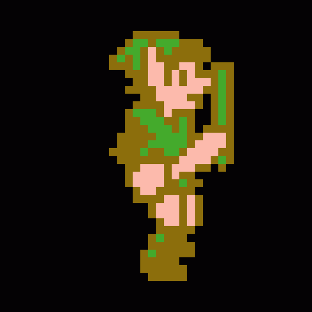
Imagine your favorite 8-bit video game (the correct answer is The Legend of Zelda, 1986). It may not be aesthetically terrible, but visual detail is not the forte of these games. Now, let’s go to 1987 for Zelda II: The Adventure of Link. We have some marginal improvement! Iterating on this process, we can improve the pixel resolution to get a crisper Link.
Climate downscaling functions on analogous lines. We are not necessarily illustrating a new image with superior detail, but rather enhancing the resolution on an existing field for any climate variable of our choosing. The advantage? Low-resolution climate and weather models can be improved to yield high-resolution field data, enabling extraordinarily precise geospatial data for specific resiliency planning. In other words, if each pixel represents a geographic area spanning 25, 50, or 100 km, downscaling can improve the spatial resolution of each pixel to be much finer, even along single-digit kilometer distances.
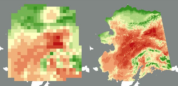
To achieve this, my colleagues have been employing a diffusion model1 from Nvidia called CorrDiff, which is capable of taking in data at a resolution of 25 km, learning the complex, nonlinear relationships between the input features, and output a downscaled map on the order of 2 km. It’s a remarkable tool, and principal motivator for me to get back to writing my solutions manual to Larry Wasserman’s All of Statistics2 to appreciate the gorgeous mathematics powering diffusion models.
Event Details
If you are a New Yorker and do not subscribe to climate doomerism, this hackathon is for you. Fear not if you are bereft of technical knowledge on coding or climate physics — this event is designed for knowledge transfer between different bodies of expertise and experiences.
The event will be held on January 15-17, 2026. The deadline to apply to join is this Friday, December 12, 2025. You can apply and learn more about the hackathon here. It will be held in-person at the American Museum of Natural History.
During the event, teams will be formed and composed of individuals from the aforementioned backgrounds, ideally with each team member having plenty to learn from their partners about their expertise. Throughout the hackathon, community organizations from the five boroughs will provide input and guidance to the teams on specific needs for climate resiliency data tools. At the end of the three days, judges will select one of the teams as the winner, with prizes I am not privy to as of yet. :-)
I hope to see some of you at the hackathon! It will be wonderful fun, and my aspiration is this will be the outset of many more fruitful collaborations on the climate crisis between folks in science research, government, and community organizing.
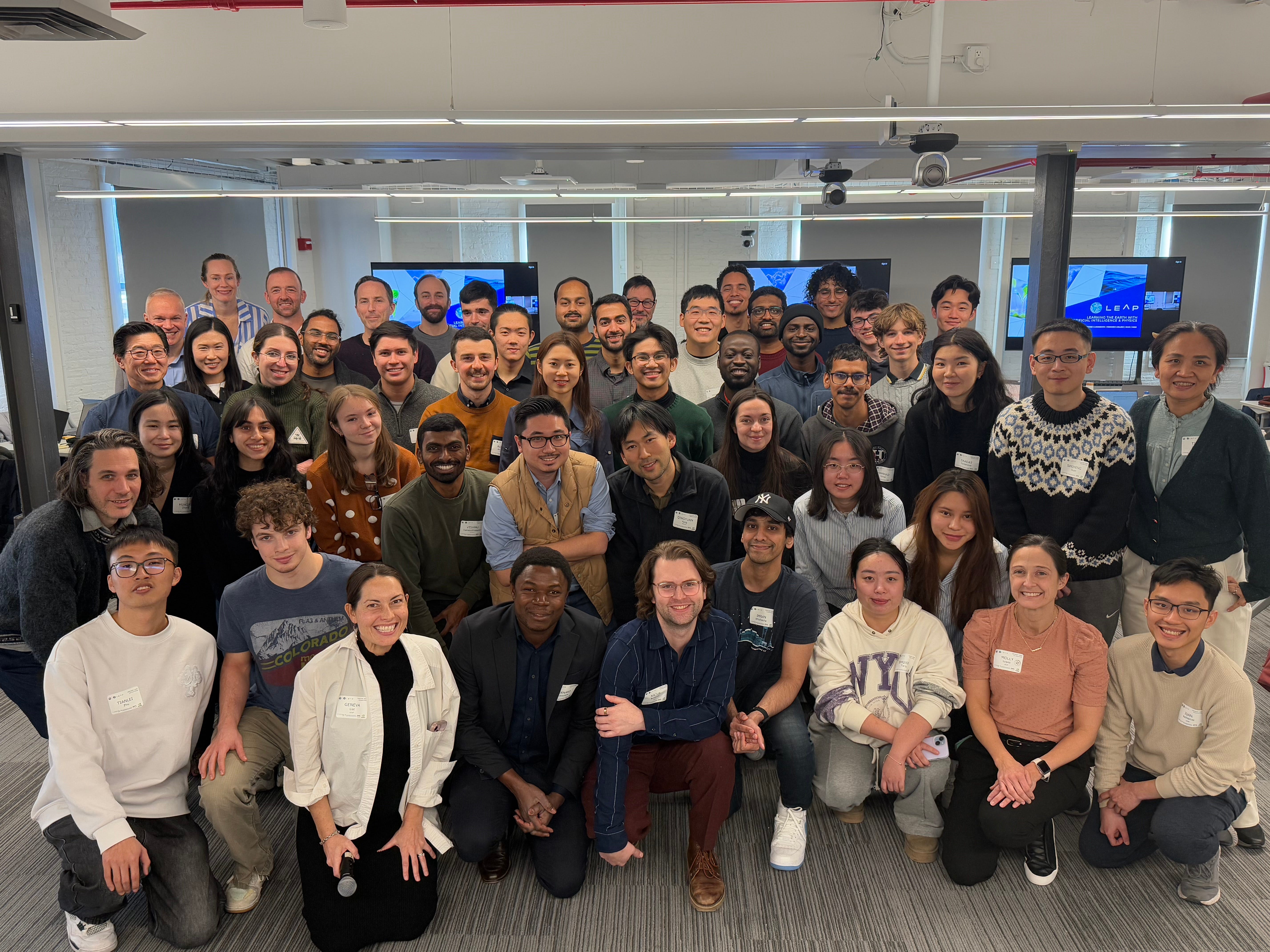
Here I am with this past year’s LEAP hackathon participants:
— David
If you’ve ever used Midjourney, or any Generative AI tool to create images, it was done through a diffusion model.
(Ah, do not allow me to get to carried away on the exquisiteness of pure mathematics and logical deduction on my policy blog.)
This is briliant work bridging technical capability with actual community needs. The insight about CorrDiff's 25km to 2km downscaling is pretty wild when you think about how granular that makes resiliency planning for specific neighboorhoods. Most climate models still operate at scales too broad for actionable urban policy, so seeing this kind of spatial precision could genuinly shift how cities prepare infrastructure.